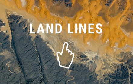
Land Lines
An experiment exploring Google Earth satellite images through gesture. Doodle to begin.
As of May 2026, Land Lines has 278 users and a 4.20/5 rating from 10 reviews.
Usersdown 10.3 percent−10.3%
278
278
Ratingno change0%
4.20
10 reviews
Reviewsno change0%
10
Version
0.0.0.2
Manifest V2
History
2 snapshotsTracking since Apr 29, 2026.
View as table
| Date | Users | Rating | Reviews | Version |
|---|---|---|---|---|
| Apr 29, 2026 | 310 | 4.20 | 10 | 0.0.0.2 |
| May 26, 2026 | 308 | 4.20 | 10 | 0.0.0.2 |
| Now | 278 | 4.20 | 10 | 0.0.0.2 |
Permissions & access
- Permissions
- None declared
- Host access
- None declared
Screenshots

About
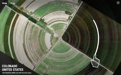
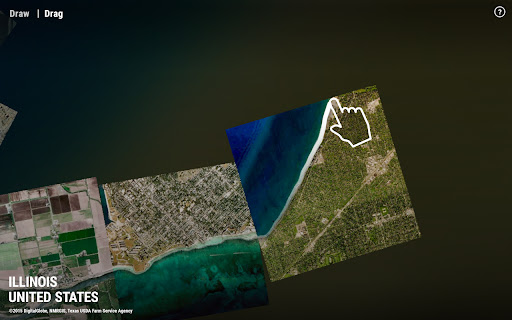
Satellite images provide a wealth of visual data from which we can visualize in interesting ways. Land Lines is an experiment that lets you explore Google Earth satellite imagery through gesture. “Draw” to find satellite images that match your every line; “Drag” to create an infinite line of connected rivers, highways and coastlines.

Using a combination of machine learning, optimized algorithms, and graphics card power, the experiment is able to run efficiently on your phone’s web browser without a need for backend servers.
Technical
- Version
- 0.0.0.2
- Manifest
- V2
- Size
- 39.24KiB
- Min Chrome
- —
- Languages
- 1
- Featured
- No
Metadata
- ID
- bomobgakipenkpiabagamabpppdhakoj
- Developer ID
- ua4a38e9083e798091344692abe3a33e3
- Developer Email
- —
- Created
- Jan 4, 2017
- Last Updated (Store)
- Jan 4, 2017
- Last Scraped
- May 26, 2026
- Website
- chromeexperiments.com
- Support URL
- —
- Privacy Policy
- —
Similar extensions
Alternatives to Land Lines, ranked by description similarity.
Earth Agent
AI-powered assistant for Google Earth Engine
91
★ 5.0
Grid Paint
An online drawing tool by various grids (squared, triangular, hexagonal).
2.0K
★ 3.3
Worldview
Experience a beautiful map from Esri every time you open a new tab.
2.0K
★ 4.8
GeoFinder - Photo Location Detector
Analyze photos to find their geographical location using AI
28
★ 4.0
Page Marker - Web Paint on Pages
Draw or highlight on any website in real time. Add text, lines, and shapes, then make screenshot the result.
10.0K
★ 5.0
Geolytics
a free Google map tool that allows you to make your own customized maps, bubble map, heatmap, cluster map, network map
—
Carla Draw
Allows drawing on existing images and saving a nice picture in SVG format
104
★ 5.0
GEE AI Assistant
Generate, modify, and fix Google Earth Engine code using AI Models. Now with new Voice Mode & 5200+ Datasets!
1.0K
★ 5.0
Data sourced from the Chrome Web Store · last verified May 26, 2026.