
TerritoryHelper - AddOn
Modify your print-out of territory cards with injected bottons to ROTATE map view, HIDE table elements, TUNE descriptions.
As of May 2026, TerritoryHelper - AddOn has 213 users and a 5.00/5 rating from 1 reviews in the Workflow & Planning category.
Usersno change0%
213
213
Ratingno change0%
5.00
1 reviews
Reviewsno change0%
1
Version
3.1
Manifest V3
History
2 snapshotsTracking since Apr 24, 2026.
View as table
| Date | Users | Rating | Reviews | Version |
|---|---|---|---|---|
| Apr 24, 2026 | 213 | 5.00 | 1 | 3.1 |
| May 21, 2026 | 224 | 5.00 | 1 | 3.1 |
| Now | 213 | 5.00 | 1 | 3.1 |
Permissions & access
- Permissions
- storage
- Host access
- None declared
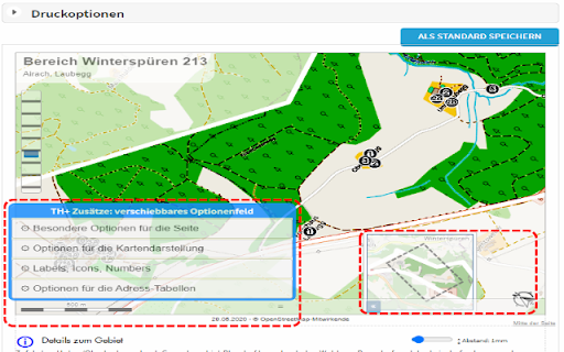
Screenshots

About
This extension was created because I had special needs for my territories.
I wished to rotate the maps for better fit in territory-card.
I wanted to change some captions...

Look my new help- and manualpages on https://thelp.mathesoft.eu

-- What does the extension?

You visit territoryhelper.com and the extension inject a lot of helpful functions and tools.

-- What's new in this version?

v3.10:
- internal bugfixes and updated libraries
- make screenshots from details of the territory card and move them between the address-tables
- export some individual territory from the overview map as GeoJson. So you have a backup, or you may import again for not paint again a complex territory border.

Known problems:
- only supported map system is OpenStreetMap
- export of statistics not possible because changes in layout
Technical
- Version
- 3.1
- Manifest
- V3
- Size
- 1.0MiB
- Min Chrome
- 100
- Languages
- 2
- Featured
- Yes
Metadata
- ID
- kelmmbafkjmcbdcmepomfkpmcggakonp
- Developer ID
- udb898e169b85bb29e04d2361c127c07a
- Developer Email
- [email protected]
- Created
- Aug 4, 2017
- Last Updated (Store)
- Aug 1, 2024
- Last Scraped
- May 21, 2026
- Website
- —
- Support URL
- https://thelp.mathesoft.eu
- Privacy Policy
- —
Similar extensions
Alternatives to TerritoryHelper - AddOn, ranked by description similarity.
polyGIS
Extension for downloading DXF files of Romanian Cadasters
493
★ 4.4
Geocaching.com Google Drive™ Notes
Integrate Google Drive™ documents to Geocaching.com to enhance notes
1.0K
★ 3.9
GeocachingUtils
A collection of useful features that enhances geocaching.com
851
★ 4.0
ROVAS Connector for iD Editor
Tracks editing session in Openstreetmap iD and sends working reports to ROVAS App.
9
Custom Shortcuts for Google Earth Web
Modify keyboard shortcuts to make browsing Google Earth Web more fluid.
180
TomTom POI/GPX Extractor & Favorites to POI (OV2) Converter
Extract and convert POI/GPX Data from https://plan.tomtom.com
295
★ 5.0
Map Overlays
Change satellite images in mapping websites.
2.0K
★ 4.5
OSM MultiToolz
Analyze OpenStreetMap changesets with quick links to various QA tools and a personal OSM watchlist.
17
Data sourced from the Chrome Web Store · last verified May 21, 2026.